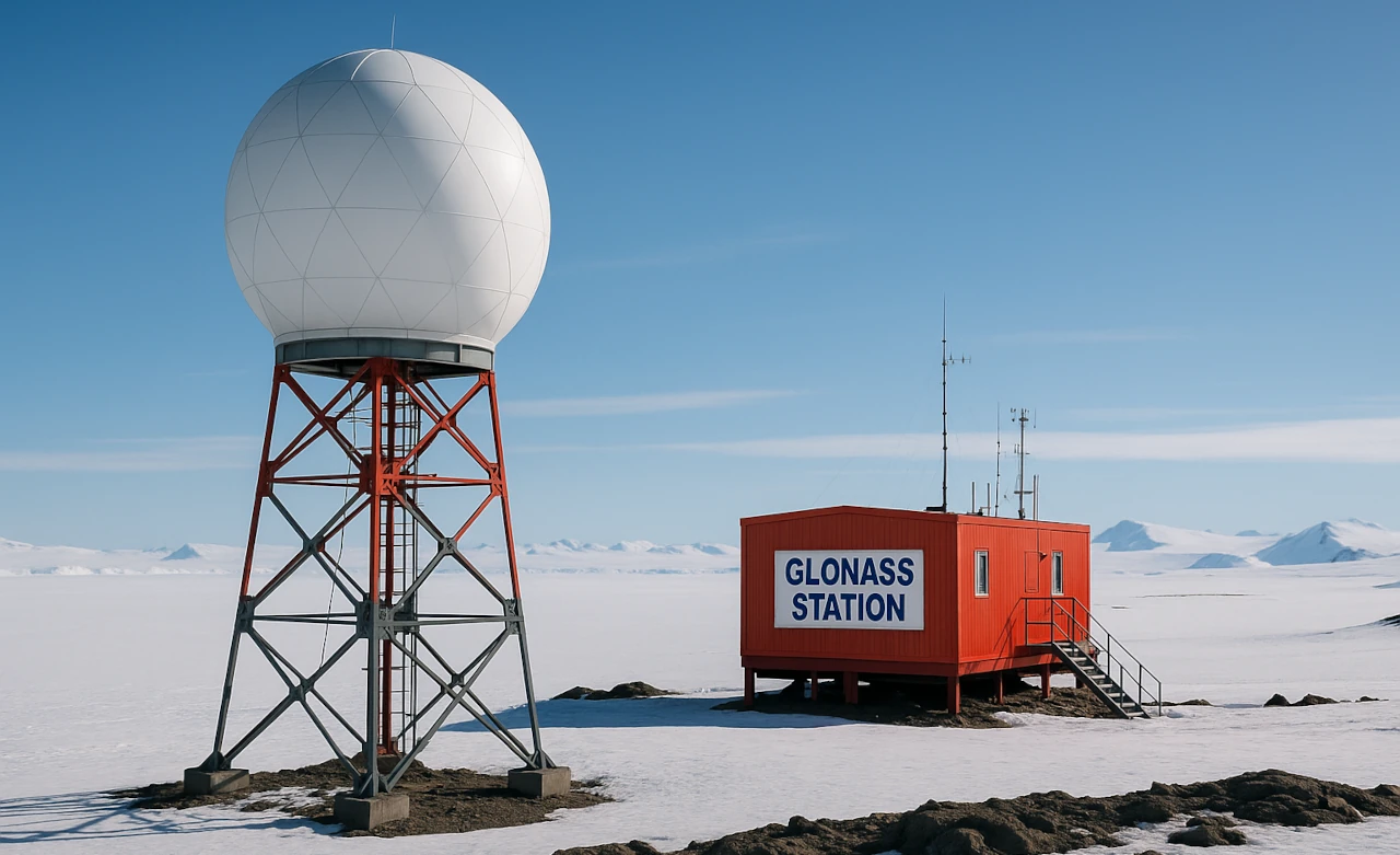
Russia is set to deploy a GLONASS station at the Russkaya Station in Antarctica. Founded in 1980, Marie Byrd Land, on the coast of West Antarctica, is home to the station. Strong hurricane winds have hampered attempts to establish a station in the location since 1973. Lack of funds for Antarctic research led to the suspension of the station’s activities in 1990, after ten years of operation. Currently, research expeditions periodically visit the station, functioning as a seasonal base. During the modernization process, it is planned to transfer the station to a year-round mode of operation.
The placement of a GLONASS unrequested measurement station at the “Russkaya” base in Antarctica will significantly expand the visibility zone of GLONASS navigation satellites over the southern part of the Pacific Ocean and the Pacific sector of Antarctica. As a result, positioning accuracy for civilian users of the GLONASS system will improve, which is especially important for regions that previously lacked ground stations capable of tracking satellites in this area. Currently, three unrequested measurement stations are deployed in Antarctica, collecting data used to generate high-precision corrections and control satellite orbits, ensuring more reliable and accurate navigation. Additionally, the information obtained is valuable for scientific research, particularly for studying ionospheric parameters.
The “Russkaya” station, located in West Antarctica on the coast of Marie Byrd Land, was established in 1980. It did not function for a long time afterward, but modernization and a transition to year-round operation are planned, which will allow systematic data collection across the entire southern satellite visibility zone.
Advantages of installing the “Russkaya” station
Installing the “Russkaya” station will greatly expand the zone of visibility of GLONASS satellites in the southern latitudes. This means the system will be able to detect and track satellites more effectively over these regions, which were previously less covered due to a lack of ground stations. Improved visibility directly translates to a higher precision in determining geographic coordinates, which is crucial for users operating in or navigating through these remote and under-monitored parts of the world.
In addition to expanding coverage, the station will increase the accuracy and reliability of navigation services for civilian users. This is particularly significant for those located in the Pacific sector of Antarctica and surrounding maritime areas, where traditional satellite navigation signals may be weaker or less consistent. Greater positioning accuracy enhances not only routine navigation but also safety and operational efficiency for activities such as scientific expeditions, shipping routes, and search and rescue operations in these challenging environments.
The station will also support scientific research by enabling more detailed ionospheric monitoring. The ionosphere affects the propagation of satellite signals, and having precise data helps in understanding space weather influences and atmospheric conditions that can disrupt or degrade navigation signals. These scientific insights contribute to developing better correction algorithms, which further improve the reliability and accuracy of the GLONASS system in these regions.
Finally, increasing the number of ground stations like “Russkaya” will improve the overall management of satellite networks. More ground stations enable enhanced generation of precise orbital corrections and better monitoring of satellite health and position in orbit. Improvements in these areas have a positive ripple effect on the entire GLONASS system, elevating its performance globally, especially in difficult-to-monitor southern latitudes.
Comparison with GPS in this context
The GPS, developed by the USA, traditionally has broader global coverage and higher accuracy in low and mid-latitudes, where most of the Earth’s population is concentrated. However, GLONASS has certain advantages in high latitudes and polar regions, including Antarctica, largely due to the higher orbital inclination of its satellites (about 64.8° for GLONASS versus 55° for GPS) and the specifics of their satellite constellation. This system provides better coverage and more stable signal reception in polar areas.
In the southern continent and the adjacent Pacific region, GLONASS with the new “Russkaya” station will be able to expand its ground control zone over satellites that are currently not visible from other stations, improving positioning accuracy and reliability. GPS provides less effective coverage in Antarctica due to the geometry of its satellite orbits. Together, the use of both systems (GPS + GLONASS) offers better positioning accuracy and more stable navigation in polar regions.
Thus, installing an unrequested GLONASS measurement station at the “Russkaya” base in Antarctica will significantly enhance the system’s capabilities for users in southern latitudes, improve the accuracy of navigation data in this remote region, and complement the coverage of the GPS, which is less effective here. This is especially important for civilian users, scientific research, and navigation safety in polar seas.
Official Website of Youtube Channel – Altitude Addicts
